
Fichier:Historical and current boundaries of Lancashire.png
Taille de cet aperçu : 411 × 600 pixels. Autres résolutions : 164 × 240 pixels | 329 × 480 pixels | 847 × 1 236 pixels.
Fichier d’origine (847 × 1 236 pixels, taille du fichier : 191 kio, type MIME : image/png)
Ce fichier et sa description proviennent de Wikimedia Commons.
Description
| Description |
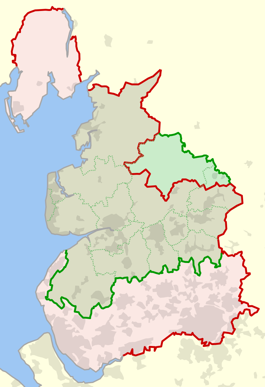
English: The historical boundary of the county of Lancashire, England, shown in red, and the modern-day boundary (since 1974), shown in green. Also shown in dotted green are the modern-day local government districts and unitary authorities of ceremonial Lancashire. |
| Date | |
| Source | Travail personnel |
| Auteur | Dr Greg |
References
- (1929) Combined index shewing civil parishes and the Ordnance Survey of Lancashire copie d'archive at the Wayback Machine, Ordnance Survey, accessed 2010-06-12
- MARIO: Maps & Related Information Online, Lancashire County Council website, accessed 2010-06-12
- OS OpenData, Ordnance Survey website, accessed 2010-06-12
Conditions d’utilisation
| Moi, propriétaire des droits d’auteur sur cette œuvre, la place dans le domaine public. Ceci s'applique dans le monde entier. Dans certains pays, ceci peut ne pas être possible ; dans ce cas : J’accorde à toute personne le droit d’utiliser cette œuvre dans n’importe quel but, sans aucune condition, sauf celles requises par la loi. |
Historique du fichier
Cliquer sur une date et heure pour voir le fichier tel qu'il était à ce moment-là.
| Date et heure | Vignette | Dimensions | Utilisateur | Commentaire | |
|---|---|---|---|---|---|
| actuel | 13 juin 2010 à 00:14 | | 847 × 1 236 (191 kio) | Dr Greg | {{Information |Description={{en|1=The historical boundary of the county of en:Lancashire, England, shown in red, and the modern-day boundary (since 1974), shown in green. Also shown in dotted green are the modern-day local government districts and u |
Utilisation du fichier
La page suivante utilise ce fichier :
Usage global du fichier
Les autres wikis suivants utilisent ce fichier :
- Utilisation sur ca.wikipedia.org
- Utilisation sur en.wikipedia.org
- Utilisation sur hu.wikipedia.org
- Utilisation sur lt.wikipedia.org
- Utilisation sur pt.wikipedia.org