
Fichier:A portion of the Amistad National Recreation Area, outside Del Rio in Val Verde County, Texas LCCN2014630589.tif

Taille de cet aperçu JPG pour ce fichier TIF : 800 × 534 pixels. Autres résolutions : 320 × 214 pixels | 640 × 427 pixels | 1 024 × 683 pixels | 1 280 × 854 pixels | 2 560 × 1 709 pixels | 7 273 × 4 854 pixels.
Fichier d’origine (7 273 × 4 854 pixels, taille du fichier : 202,04 Mio, type MIME : image/tiff)
Ce fichier et sa description proviennent de Wikimedia Commons.
Description
| Description |
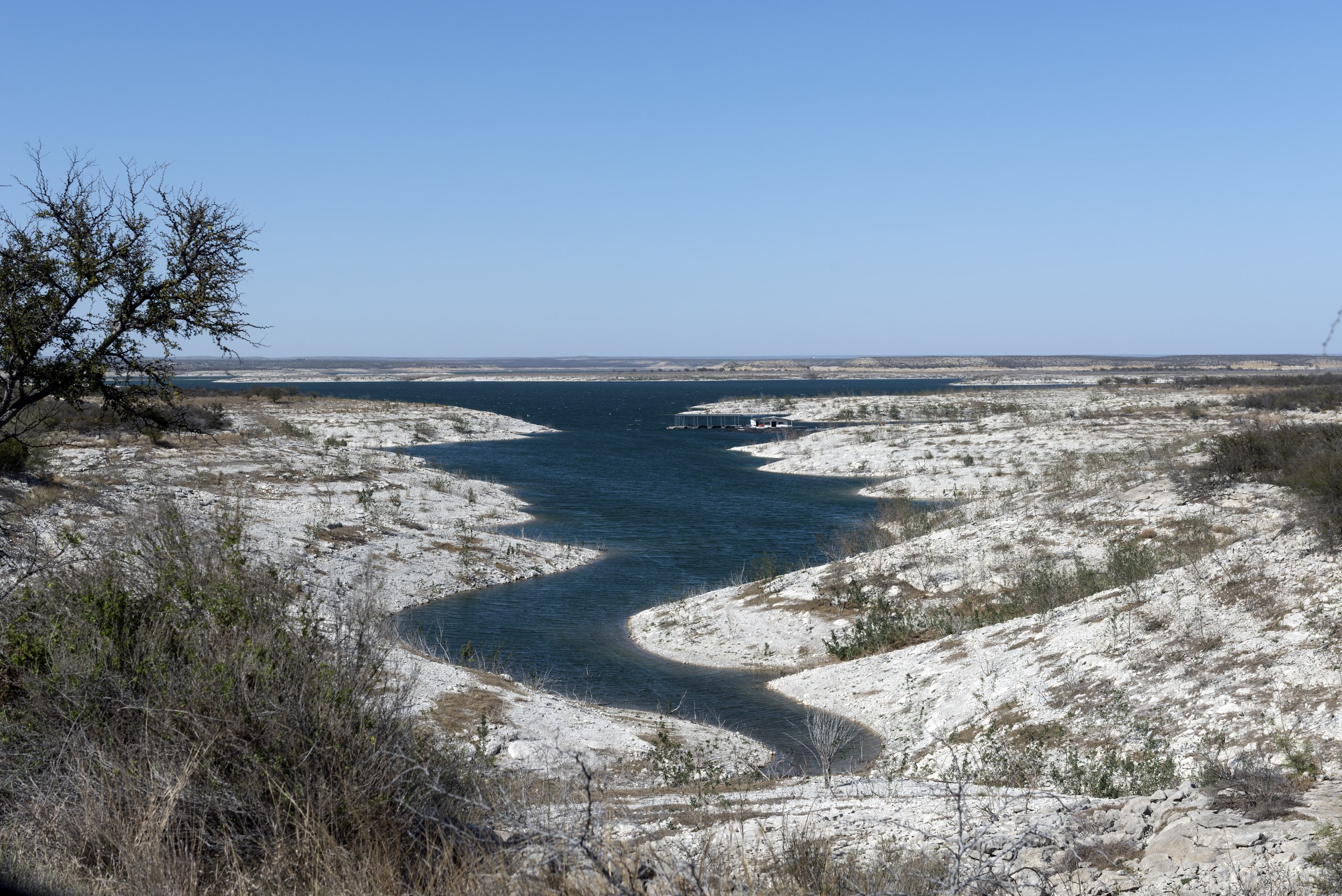
English: Title: A portion of the Amistad National Recreation Area, outside Del Rio in Val Verde County, Texas
Physical description: 1 photograph : digital, tiff file, color. Notes: Title, date, and keywords based on information provided by the photographer.; Credit line: The Lyda Hill Texas Collection of Photographs in Carol M. Highsmith's America Project, Library of Congress, Prints and Photographs Division.; Forms part of: Lyda Hill Texas Collection of Photographs in Carol M. Highsmith's America Project in the Carol M. Highsmith Archive.; Gift; The Lyda Hill Foundation; 2014; (DLC/PP-2014:054).; Managed by National Park Service,the area includes the Amistad Reservoir at the confluence of the Rio Grande, the Devils River, and the Pecos River. Amistad, Spanish for "friendship," refers broadly to the close relationship and shared history between Ciudad Acu±a and Del Rio. The waters of the recreation area are popular destinations for fishers and boaters. |
||||||||||||||||||||||||||
| Date | Prise le 16 mars 2014, 16:34 (d'après les données Exif) | ||||||||||||||||||||||||||
| Source |
Library of Congress
|
||||||||||||||||||||||||||
| Auteur |
|
||||||||||||||||||||||||||
| Autorisation (Réutilisation de ce fichier) |
No known restrictions on publication.
|
||||||||||||||||||||||||||


| Lieu de la prise de vue | | Voir cet endroit et d’autres images sur : OpenStreetMap |
|---|
Conditions d’utilisation
| Cette œuvre est issue de la Carol M. Highsmith Archive collection de la Bibliothèque du Congrès. Selon la bibliothèque, il n'existe aucune restriction connue en matière de droits d'auteur pour l'utilisation de cette œuvre. Carol M. Highsmith has stipulated that her photographs are in the public domain. Photographs of sculpture or other works of art may be restricted by the copyright of the artist. |
 |
Historique du fichier
Cliquer sur une date et heure pour voir le fichier tel qu'il était à ce moment-là.
| Date et heure | Vignette | Dimensions | Utilisateur | Commentaire | |
|---|---|---|---|---|---|
| actuel | 5 septembre 2016 à 22:49 |  | 7 273 × 4 854 (202,04 Mio) | Fæ | LOC 2014630589, Carol M. Highsmith collection. P220.10539 TIFF (202.0mb) |
Utilisation du fichier
Les 2 pages suivantes utilisent ce fichier :